-
City Services
-
- Departments Administration Building City Recorder Community Development Community Emergency Response Team Finance Floodplain Management Human Resources Parks & Recreation Public Works Police Urban Renewal Utility Billing
- Commissions and Committees Arts Commission Budget Committee Citizen Advisory Committee Parks Foundation Parks and Recreation Commission Planning Commission
-
Agendas and Minutes
City Council
-
-
Community
-
- Schools Crater High Scenic Middle Central Point Elementary Mae Richardson Elementary Jewett Elementary School District 6 Map Rogue Community College Southern Oregon University
- Special Events Calendar of Events Park Special Events Recreation City Activity Guide City Parks British Soccer Camp Jackson County Expo Bear Creek Greenway Bike Path Rogue River Greenway Bike Path Hiking Paths Made in Southern Oregon
- New to Central Point Chamber of Commerce Central Point Library Justice Court Utility Services Senior Center Post Office Airport Get Involved Commissions & Committees Volunteer Parks Foundation Elections
-
-
Resources
-
- Online Resources Pay Your Water Bill Pay a Ticket Online Job Opportunities Municipal Code Documents and Reports Forms and Applications City Documents Library Portal Water Usage Portal COVID-19 Updates Alerts and Notifications Email Subscriptions Maps
- Events and Meetings Agendas and Minutes Ordinances Resolutions Calendar Local Services Jackson County City of Medford Justice Court Recycling
- Connect Submit a Request or Concern Staff Directory Facebook Twitter In the News City News City Newsletters
-
-
Business
-
- Start a Business Business Licenses Chamber of Commerce Building/Construction Building Permits Inspection Requests Design Criteria Building Forms Bids and RFPs Forms and Permits
- Community Development City Projects Zoning & Land Development Code Long Range Planning Maps
- Urban Renewal Urban Renewal Home
-
-
Public Safety
-
- Communications Mission & Core Values Organizational Chart What We Do Patrol School Resource Officers (SRO) Community Service Officers Police Support Specialists Police Volunteers
- Get Involved Join the Team Becoming a Volunteer Neighborhood Watch Community Emergency Response Team Requests Police Reports and Records Check
- Resources Municipal Code Traffic Safety Police Events/Calendar Court Information Vehicle Impound Release Frequently Asked Questions
-
Knowing and understanding flood risk is the key to making informed decisions when buying, building or living in a flood-prone community. Provide below is a summary of the Central Point flood hazards, flood studies and mapping resources, structure specific flood risk data, and services offered by the City.
Central Point Flood Hazards
Central Point is impacted by stream and urban flooding. Stream floods occur when water levels within a stream fill the channel and overflow onto adjacent lands. Urban floods originate from the urban landscape (i.e. streets, rooftops, parking lots, etc.) and tend to occur when storm drain systems become blocked or are overwhelmed. These floods have the potential to threaten life, safety and property.
Stream/Overbank Floods
The City has seven (7) streams susceptible to annual flooding, including: Bear, Griffin, Jackson, Mingus, Horn, Daisy, and Elk Creek.
Based on the current FIRM, there are 203 acres and 395 parcels within the high risk floodplain (1% annual chance). Most overbank flood events in Central Point occur when prolonged rain combines with snow melt in the surrounding mountains. The 1997 New Year’s Day flood is the most recent flood event to occur in the City. It caused damage to private property and public infrastructure. County-wide over 1,500 people had to be evacuated.
Urban Floods
Urban floods are more difficult to predict because much of the storm drain system is underground. Physical obstructions (i.e. debris) and insufficient system capacity can cause water to flood streets and low lying areas within town. In spring 2009 and summer 2010, thunderstorms caused urban flooding, which impacted private and public properties. Low lying areas within the older parts of town were most affected.
Flood Maps & Studies
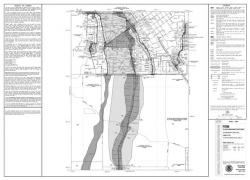
The first step to understanding risk is identifying where your property and structures sit in relation to mapped floodplains. The Federal Emergency Management Agency (FEMA) produces Flood Insurance Studies and Flood Insurance Rate Maps (FIRM). These resources describe flood hazards based on the best available science and information available. They serve the basis for determining when floodplain development and insurance requirements apply to structures. The City's first FIRM was published in 1982. This was updated in 2011 and revised in September 2016 to reflect floodway mitigation activities in the Twin Creeks Development. You can review any of the City's flood study and mapping documents in the Supporting Documents below.
Elevation Certificates
Elevation Certificates are federal forms used to document a structure's flood risk. Although they are primarily used to rate insurance policies, the City uses Elevation Certificates to document floodplain development compliance and to assess flood mitigation options.
Flood Map Information Service
The City offers free map information including personalized maps showing your property in relation to flood hazard areas, flood elevations, water depth, and flood history. In addition, our staff provides information about known erosion hazard areas and environmentally sensitive areas. If your structure is located in a high risk flood hazard area, we also provide consultations for property protection options that may be available to reduce your risk and insurance cost. Call our office or email one of our staff to request information or assistance.

